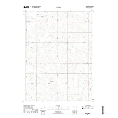
2017 Map of Altona NW
USGS Topo · Published 2017About this map
The southeastern outskirts of Wayne and the surrounding agricultural landscape define this portion of Wayne County. The terrain is marked by the winding paths of S Logan Cr and Coon Cr, which drain the rolling prairie of northeast Nebraska. A key local landmark, the Wayne Municipal Airport/ Stan Morris Field, occupies the northwest corner near the city limits, while a network of rural roads such as Stringer Rd and 580th Ave organize the farmsteads of the region. For those researching local family history, the LaPorte Cem is a notable point of interest, located along 854th Rd. The map illustrates the persistent section-line grid system typical of the Great Plains, showing how drainage features like Kane Cr and Plum Cr intersect with human-made boundaries and transportation routes.
Find a feature on this map
28 named features on this map. Tap any name to fly to it.
Don’t see what you’re looking for? This feature index may not catch every label — zoom into the map to look around manually.
Map Details
Editions of this 2017 Altona NW Map
This is the sole edition of this map. No revisions or reprints were ever made.
Other maps of this area

1955 · Sioux City
USGS Topo · 1:250,000

1958 · Sioux City
USGS Topo · 1:250,000

1959 · Sioux City
USGS Topo · 1:250,000

1963 · Pilger
USGS Topo · 1:24,000

1963 · Altona
USGS Topo · 1:24,000

1963 · Wayne
USGS Topo · 1:24,000

1966 · Altona NW
USGS Topo · 1:24,000
1966 · Altona SE
USGS Topo · 1:24,000

1966 · Altona NE
USGS Topo · 1:24,000

1967 · Wakefield SW
USGS Topo · 1:24,000