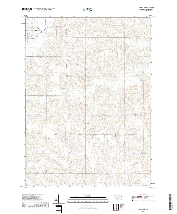
2021 Map of Altona NW
USGS Topo · Published 2021About this map
The Wayne city limits and the Wayne Municipal Airport/ Stan Morris Field occupy the northwest corner of this Northeast Nebraska landscape. As recorded in 2021, the surrounding territory is defined by a rigorous section-line road grid, including Stringer Rd and 577th Ave, which segments the agricultural land across T26n R4e and T25n R4e.
Find a feature on this map
26 named features on this map. Tap any name to fly to it.
Don’t see what you’re looking for? This feature index may not catch every label — zoom into the map to look around manually.
Map Details
Editions of this 2021 Altona NW Map
This is the sole edition of this map. No revisions or reprints were ever made.
Other maps of this area

1955 · Sioux City
USGS Topo · 1:250,000

1958 · Sioux City
USGS Topo · 1:250,000

1959 · Sioux City
USGS Topo · 1:250,000

1963 · Pilger
USGS Topo · 1:24,000

1963 · Altona
USGS Topo · 1:24,000

1963 · Wayne
USGS Topo · 1:24,000

1966 · Altona NW
USGS Topo · 1:24,000
1966 · Altona SE
USGS Topo · 1:24,000

1966 · Altona NE
USGS Topo · 1:24,000

1967 · Wakefield SW
USGS Topo · 1:24,000