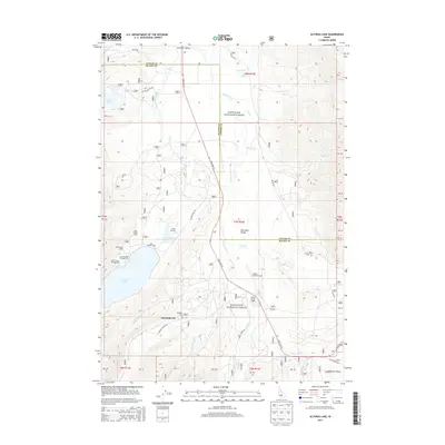
2013 Map of Alturas Lake
USGS Topo · Published 2013About this map
Sawtooth City lies at the southern end of the Sawtooth Valley, a high-altitude basin where the headwaters of the Salmon River begin their journey. This landscape, dominated by the Sawtooth National Forest, is defined by a series of glacial lakes including Alturas Lake, Pettit Lake, and Perkins Lake. The settlement patterns here reflect a mix of historic mining roots, evidenced by the Sawtooth Cemetery, and a long-standing recreation economy. Lodges and seasonal camps such as Smokey Bear Lodge, Lake Alturas Lodge, and Camp Perkins dot the shoreline and forest edge, while State Highway 75 provides the primary transit artery through the valley. The presence of the Smiley Creek Airport and nearby Smiley Creek Lodge further underscores the area's role as a gateway for backcountry access and wilderness exploration in the early 21st century.
Find a feature on this map
39 named features on this map. Tap any name to fly to it.
Don’t see what you’re looking for? This feature index may not catch every label — zoom into the map to look around manually.
Map Details
Editions of this 2013 Alturas Lake Map
This is the sole edition of this map. No revisions or reprints were ever made.
Other maps of this area

1900 · Sawtooth
USGS Topo · 1:125,000

1919 · Custer
USGS Topo · 1:125,000

1922 · Custer
USGS Topo · 1:125,000

1955 · Hailey
USGS Topo · 1:250,000

1957 · Challis
USGS Topo · 1:250,000

1959 · Hailey
USGS Topo · 1:250,000

1960 · Challis
USGS Topo · 1:250,000

1962 · Hailey
USGS Topo · 1:250,000

1963 · Challis
USGS Topo · 1:250,000

1963 · Mt Cramer
USGS Topo · 1:24,000