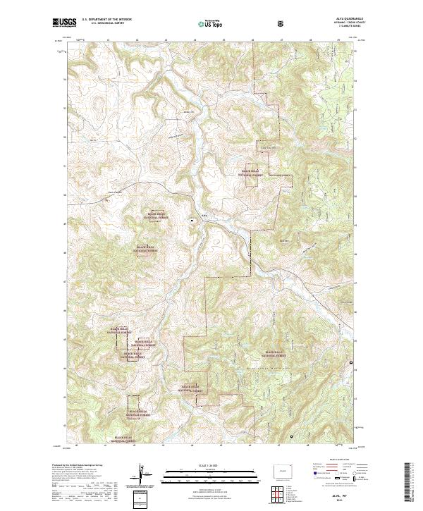
2021 Map of Alva
USGS Topo · Published 2021About this map
Alva sits at a crossroads of ranch roads and forest routes in northeastern Wyoming, characterized by the dramatic ascent into the Black Hills National Forest. The landscape transitions from the winding valley of Beaver Cr to the higher elevations of the Bear Lodge Mountains in the south. This area is defined by its numerous springs and draws, such as Mahoney Draw and Reservoir Gulch, which provide critical water sources in the semi-arid terrain. Genealogists and local historians will find the Alva Cem near the town center, a quiet record of the families who settled this corner of Crook County. To the east, landmarks like Bald Mtn and Vision Peak overlook a network of seasonal water bodies, including Wood Reservoir and Lost Spring, illustrating the importance of water management in this high-country cattle and timber region.
Find a feature on this map
43 named features on this map. Tap any name to fly to it.
Don’t see what you’re looking for? This feature index may not catch every label — zoom into the map to look around manually.
Map Details
Editions of this 2021 Alva Map
This is the sole edition of this map. No revisions or reprints were ever made.
Other maps of this area

1901 · Aladdin
USGS Topo · 1:125,000

1903 · Aladdin
USGS Topo · 1:125,000

1905 · Devils Tower
USGS Topo · 1:125,000

1954 · Gillette
USGS Topo · 1:250,000

1955 · Devils Tower
USGS Topo · 1:62,500

1955 · Gillette
USGS Topo · 1:250,000

1957 · Mona
USGS Topo · 1:62,500

1957 · Seely
USGS Topo · 1:62,500

1958 · Gillette
USGS Topo · 1:250,000

1962 · Gillette
USGS Topo · 1:250,000