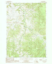
1984 Map of Alva
USGS Topo · Published 1985About this map
Alva serves as the primary point of settlement in this northern pocket of the Black Hills National Forest, where the landscape is defined by the complex drainage systems of Beaver Creek and Lame Jones Creek. This 1984 survey reveals a transition between prominent heights like Vision Peak and the deep incisions of Bear Lodge Canyon. The small community at Alva is marked by its proximity to the Alva Cem, providing a focal point for genealogical research in this part of Crook County.
Find a feature on this map
37 named features on this map. Tap any name to fly to it.
Don’t see what you’re looking for? This feature index may not catch every label — zoom into the map to look around manually.
Map Details
Editions of this 1984 Alva Map
This is the sole edition of this map. No revisions or reprints were ever made.
Other maps of this area

1901 · Aladdin
USGS Topo · 1:125,000

1903 · Aladdin
USGS Topo · 1:125,000

1905 · Devils Tower
USGS Topo · 1:125,000

1954 · Gillette
USGS Topo · 1:250,000

1955 · Devils Tower
USGS Topo · 1:62,500

1955 · Gillette
USGS Topo · 1:250,000

1957 · Mona
USGS Topo · 1:62,500

1957 · Seely
USGS Topo · 1:62,500

1958 · Gillette
USGS Topo · 1:250,000

1962 · Gillette
USGS Topo · 1:250,000