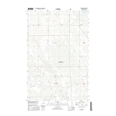
2016 Map of Alvwood
USGS Topo · Published 2016About this map
Alvwood and the smaller settlement of Rosy anchor this northern Minnesota landscape, characterized by the extensive wetlands and dense woodlands of the Chippewa National Forest. The map documents a territory defined by its water systems, including the Popple River winding through the north and the Third River in the south, connecting numerous basins like Rosy Lake and Little Dixon Lake. For local historians and genealogists, the inclusion of the Moose Park Township Cem and Rosy Cem provides critical points of reference for early area residents. The road network, comprising routes like Co Rd 13 and Safe Rd, reveals how the community remained integrated with the surrounding forest economy. This 2016 survey captures the persistent rural character of Itasca County, where drainage features like Dunbar Cr and Skimmerhorn Cr continue to shape the geography of the township.
Find a feature on this map
31 named features on this map. Tap any name to fly to it.
Don’t see what you’re looking for? This feature index may not catch every label — zoom into the map to look around manually.
Map Details
Editions of this 2016 Alvwood Map
This is the sole edition of this map. No revisions or reprints were ever made.
Other maps of this area

1919 · Rosy
USGS Topo · 1:62,500

1919 · Gemmell
USGS Topo · 1:62,500

1919 · Max
USGS Topo · 1:62,500

1919 · Bridgie
USGS Topo · 1:62,500

1924 · Bridgie
USGS Topo · 1:62,500

1954 · Bemidji
USGS Topo · 1:250,000

1957 · Bemidji
USGS Topo · 1:250,000

1958 · Bemidji
USGS Topo · 1:250,000

1971 · Squaw Lake
USGS Topo · 1:24,000

1971 · Dixon Lake
USGS Topo · 1:24,000