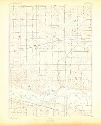
1888 Map of Amana
USGS Topo · Published 1888About this map
Amana and its surrounding villages stand as a communal heart along the Iowa River in this late nineteenth-century survey. The landscape is defined by the seven distinct settlements of the Amana Colonies, including West Amana, Middle Amana, Hohe Amana, and East Amana. This area reflects a highly organized communal agricultural society, where the river valley and its bottomlands provided the resource base for self-sufficiency.
Find a feature on this map
33 named features on this map. Tap any name to fly to it.
Don’t see what you’re looking for? This feature index may not catch every label — zoom into the map to look around manually.
Map Details
Editions of this 1888 Amana Map
This is the sole edition of this map. No revisions or reprints were ever made.
Other maps of this area
1887 · Cedar Rapids
USGS Topo · 1:62,500
1888 · Shellsburg
USGS Topo · 1:62,500
1888 · Marion
USGS Topo · 1:62,500
1889 · Marion
USGS Topo · 1:62,500
1889 · Amana
USGS Topo · 1:62,500
1889 · Shellsburg
USGS Topo · 1:62,500
1891 · Oxford
USGS Topo · 1:62,500
1891 · Cedar Rapids
USGS Topo · 1:62,500
1891 · Iowa City
USGS Topo · 1:62,500
1894 · Oxford
USGS Topo · 1:62,500