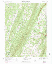
1967 Map of Amaranth
USGS Topo · Published 1983About this map
Addison Ridge and Sideling Hill dominate this topographic landscape in the late 1960s, framing a series of narrow valleys where agricultural and extractive life persisted. The village of Robinsonville sits tucked between the ridges, while the tiny hamlet of Amaranth serves as a local crossroads near McKees Run. This period was marked by the presence of numerous Gas Wells scattered across Monroe Town, indicating the active energy development of the era alongside traditional rural settlements like Buck Valley and Silver Mills.
Find a feature on this map
44 named features on this map. Tap any name to fly to it.
Don’t see what you’re looking for? This feature index may not catch every label — zoom into the map to look around manually.
Map Details
Editions of this 1967 Amaranth Map
4 editions found
Other maps of this area

1898 · Paw Paw
USGS Topo · 1:62,500

1899 · Hancock
USGS Topo · 1:62,500

1900 · Pawpaw
USGS Topo · 1:62,500

1901 · Hancock
USGS Topo · 1:62,500

1910 · Paw Paw
USGS Topo · 1:62,500

1925 · Needmore
USGS Topo · 1:48,000

1927 · Clearville
USGS Topo · 1:48,000

1931 · Clearville
USGS Topo · 1:62,500

1935 · Needmore
USGS Topo · 1:62,500

1939 · Needmore
USGS Topo · 1:62,500
Featured Places
- Bethel Township, PA
- Union Township, PA
- Mann Township, PA
- Brush Creek Township, PA
- Point View, Union Township