
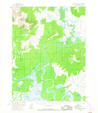
2016 Map of Ambler River A-4 SE
USGS Topo · Published 2016About this map
The Kobuk River meanders across this landscape in the Northwest Arctic, carving a complex network of wetlands and oxbow lakes. The elevation shifts dramatically from the riverbanks up to the northern heights of Ingricherk Mtn, where the terrain rises above 1,500 feet. This 2016 survey documents the shifting hydrography of the Arctic river system, highlighting the many seasonal watercourses and drainages like Rabbit Cr and Pitkik Cr that feed into the larger basin. The presence of Pitkik Lake and the confluence of Kugachevik Cr in the south illustrate a landscape defined by water and drainage patterns in a region where traditional land use and environmental shifts are inextricably linked to the river's path.
Find a feature on this map
10 named features on this map. Tap any name to fly to it.
Don’t see what you’re looking for? This feature index may not catch every label — zoom into the map to look around manually.
Map Details
Editions of this 2016 Ambler River A-4 SE Map
This is the sole edition of this map. No revisions or reprints were ever made.
Other maps of this area

1951 · Shungnak
USGS Topo · 1:250,000

1951 · Ambler River
USGS Topo · 1:250,000

1955 · Shungnak
USGS Topo · 1:250,000

1955 · Ambler River A-4
USGS Topo · 1:63,360

1955 · Shungnak D-4
USGS Topo · 1:63,360

1955 · Shungnak D-3
USGS Topo · 1:63,360

1956 · Ambler River
USGS Topo · 1:250,000

1964 · Shungnak
USGS Topo · 1:250,000

1964 · Ambler River
USGS Topo · 1:250,000
1966 · Ambler River A-4
USGS Topo · 1:63,360