
1955 Map of Shungnak D-4
USGS Topo · Published 1959About this map
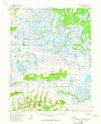
The Sheklukshuk Range dominates the southern landscape of this mid-century Alaskan interior survey, providing a stark topographical contrast to the expansive, water-filled lowlands to the north. Waterways define the region's geography, with the winding Kobuk River and Kogoluktuk River carving through the terrain alongside the smaller Black River and Black Creek. These drainages create a complex network of marshes and small lakes characteristic of the northern wilderness before modern infrastructure.
Find a feature on this map
10 named features on this map. Tap any name to fly to it.
Don’t see what you’re looking for? This feature index may not catch every label — zoom into the map to look around manually.
Map Details
Editions of this 1955 Shungnak D-4 Map
2 editions found
Other maps of this area

1951 · Shungnak
USGS Topo · 1:250,000

1951 · Ambler River
USGS Topo · 1:250,000

1955 · Shungnak
USGS Topo · 1:250,000

1955 · Ambler River A-4
USGS Topo · 1:63,360

1955 · Shungnak D-5
USGS Topo · 1:63,360

1955 · Shungnak D-3
USGS Topo · 1:63,360

1955 · Ambler River A-5
USGS Topo · 1:63,360

1956 · Ambler River
USGS Topo · 1:250,000

1964 · Shungnak
USGS Topo · 1:250,000

1964 · Ambler River
USGS Topo · 1:250,000