
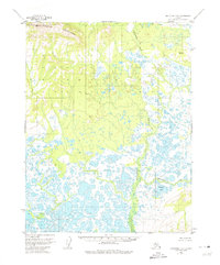
1955 Map of Shungnak D-5
USGS Topo · Published 1959About this map
The Waring Mountains dominate the northwestern horizon of this Arctic landscape, where high ridgelines give way to a complex network of lowland wetlands. In the mid-1950s, this region of the Northwest Arctic was characterized by its intricate drainage patterns, most notably the meandering course of Kichuvak Creek and the broad waters of Egaupak Lake. The surveyor's presence is etched into the terrain via numerous vertical angle bench marks, such as VABM 2112 Waring and VABM 557 Wood, which provided the essential control points for mapping this roadless expanse. This survey reveals a landscape defined by thousands of small ponds and thaw lakes, illustrating the dynamic permafrost-driven hydrology of the Alaskan interior during the postwar era.
Find a feature on this map
7 named features on this map. Tap any name to fly to it.
Don’t see what you’re looking for? This feature index may not catch every label — zoom into the map to look around manually.
Map Details
Editions of this 1955 Shungnak D-5 Map
3 editions found
Other maps of this area

1951 · Shungnak
USGS Topo · 1:250,000

1951 · Ambler River
USGS Topo · 1:250,000

1955 · Shungnak
USGS Topo · 1:250,000

1955 · Ambler River A-4
USGS Topo · 1:63,360

1955 · Ambler River A-6
USGS Topo · 1:63,360

1955 · Shungnak D-4
USGS Topo · 1:63,360

1955 · Shungnak D-6
USGS Topo · 1:63,360

1955 · Ambler River A-5
USGS Topo · 1:63,360

1956 · Ambler River
USGS Topo · 1:250,000

1964 · Shungnak
USGS Topo · 1:250,000