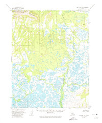
1955 Map of Shungnak D-5
USGS Topo · Published 1974About this map
The Waring Mountains dominate the northern landscape of this interior terrain, where high peaks like Vabm 2102 Waring overlook a dense network of water bodies and wetlands. To the south, the environment transitions into a complex pattern of thaw lakes and winding waterways, centered on the broad Kugarak River valley. This 1955 survey illustrates the land as it remained prior to modern development, preserving the unsurveyed and unmarked locations predetermined by the Bureau of Land Management. The map provides a detailed view of the hydrology of the region, specifically identifying features like Egaupak Lake and Nakochelik Creek. Several Vertical Angle Bench Marks, such as Vabm 557 Wood and Vabm 271 Sand, serve as the primary landmarks in an area defined by its lack of roads or permanent trails, marking essential reference points for early surveyors and bush pilots.
Find a feature on this map
9 named features on this map. Tap any name to fly to it.
Don’t see what you’re looking for? This feature index may not catch every label — zoom into the map to look around manually.
Map Details
Editions of this 1955 Shungnak D-5 Map
3 editions found
Other maps of this area

1951 · Shungnak
USGS Topo · 1:250,000

1951 · Ambler River
USGS Topo · 1:250,000

1955 · Shungnak
USGS Topo · 1:250,000

1955 · Ambler River A-4
USGS Topo · 1:63,360

1955 · Ambler River A-6
USGS Topo · 1:63,360

1955 · Shungnak D-4
USGS Topo · 1:63,360

1955 · Shungnak D-6
USGS Topo · 1:63,360

1955 · Shungnak D-5
USGS Topo · 1:63,360

1955 · Ambler River A-5
USGS Topo · 1:63,360

1956 · Ambler River
USGS Topo · 1:250,000