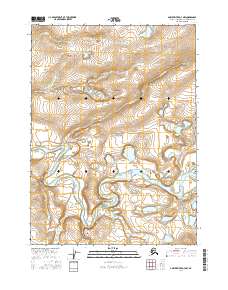
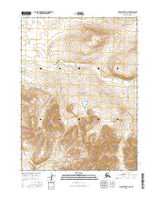
2016 Map of Ambler River D-3 NW
USGS Topo · Published 2016About this map
Noatak National Preserve encompasses a significant portion of this landscape in the Northwest Arctic region of Alaska, showcasing a remote wilderness defined by its intricate waterways. The Noatak River dominates the lower half of the quadrangle, carving a wide and meandering path through the terrain. Its complex oxbow lakes and side channels suggest a dynamic fluvial system that reshapes the valley floor over time. In the northern reaches, the Atongarak Cr winds through higher elevations, feeding into the broader drainage network. This 2016 survey by the U.S. Geological Survey provides a precise topographic record of these Arctic corridors, where the absence of roads or permanent settlements underscores the preserve's role as a protected ecological sanctuary.
Find a feature on this map
7 named features on this map. Tap any name to fly to it.
Don’t see what you’re looking for? This feature index may not catch every label — zoom into the map to look around manually.
Map Details
Editions of this 2016 Ambler River D-3 NW Map
This is the sole edition of this map. No revisions or reprints were ever made.
Other maps of this area

1951 · Howard Pass
USGS Topo · 1:250,000

1951 · Ambler River
USGS Topo · 1:250,000

1956 · Howard Pass
USGS Topo · 1:250,000

1956 · Ambler River
USGS Topo · 1:250,000

1964 · Ambler River
USGS Topo · 1:250,000

1984 · Howard Pass A-3
USGS Topo · 1:63,360
1990 · Ambler River D-4
USGS Topo · 1:63,360
1990 · Ambler River D-3
USGS Topo · 1:63,360
2016 · Ambler River D-4 SE
USGS Topo · 1:25,000
2016 · Ambler River D-3 SE
USGS Topo · 1:25,000