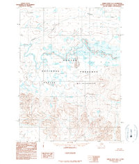
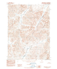
1990 Map of Ambler River D-3
USGS Topo · Published 1990About this map
Noatak River dominates the central landscape of this 1990 provisional study, winding through a complex system of braided channels and wetlands. The map represents a significant portion of the Noatak National Preserve and the protected Noatak Wilderness, illustrating a region defined by its lack of permanent settlements or infrastructure. The braided river system and numerous unnamed lakes are contrasted by the sharp rise of mountainous terrain in the southern portion of the quadrangle. North of the main river, the drainage of Atongarak Creek and the area around Atongarak reflect a typical Arctic hydrological pattern. This survey, compiled from aerial photography taken between 1977 and 1980, captures the pristine state of this protected landscape before the close of the twentieth century.
Find a feature on this map
5 named features on this map. Tap any name to fly to it.
Don’t see what you’re looking for? This feature index may not catch every label — zoom into the map to look around manually.
Map Details
Editions of this 1990 Ambler River D-3 Map
This is the sole edition of this map. No revisions or reprints were ever made.
Other maps of this area

1951 · Howard Pass
USGS Topo · 1:250,000

1951 · Ambler River
USGS Topo · 1:250,000

1956 · Howard Pass
USGS Topo · 1:250,000

1956 · Ambler River
USGS Topo · 1:250,000

1964 · Ambler River
USGS Topo · 1:250,000
1984 · Howard Pass A-2
USGS Topo · 1:63,360

1984 · Howard Pass A-3
USGS Topo · 1:63,360
1990 · Ambler River D-4
USGS Topo · 1:63,360
1990 · Ambler River D-2
USGS Topo · 1:63,360
1990 · Ambler River C-2
USGS Topo · 1:63,360