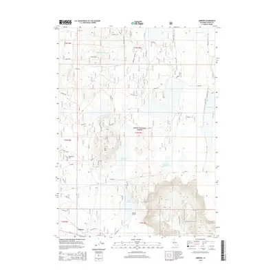
2015 Map of Ambrose
USGS Topo · Published 2015About this map
Ambrose occupies a quiet corner of Modoc County in this high-desert landscape within the Modoc National Forest. The map documents a sophisticated system of water management for livestock and wildlife, featuring the Six-Shooter Stock Tank, Hidden Basin Stock Tank, and several named reservoirs like Duncan Reservoir. These water sources are essential across the varying terrain, from the level expanse of Sevenmile Flat to the volcanic prominence of Rail Mtn. Transportation through this isolated region is marked by historic routes including Tichnor Road and Old Loveness Rd, which skirt the northern edge of Blacks Canyon. The presence of Browns Well further emphasizes the importance of groundwater in this arid territory where the forest boundary meets private landholdings.
Find a feature on this map
23 named features on this map. Tap any name to fly to it.
Don’t see what you’re looking for? This feature index may not catch every label — zoom into the map to look around manually.
Map Details
Editions of this 2015 Ambrose Map
This is the sole edition of this map. No revisions or reprints were ever made.
Other maps of this area

1886 · Alturas
USGS Topo · 1:250,000

1886 · Modoc Lava Bed
USGS Topo · 1:250,000

1892 · Modoc Lava-Bed
USGS Topo · 1:250,000

1892 · Alturas
USGS Topo · 1:250,000

1952 · Hackamore
USGS Topo · 1:62,500

1954 · Alturas
USGS Topo · 1:250,000

1958 · Alturas
USGS Topo · 1:250,000

1961 · Canby
USGS Topo · 1:62,500

1962 · Alturas
USGS Topo · 1:250,000

1962 · Crank Mountain
USGS Topo · 1:62,500