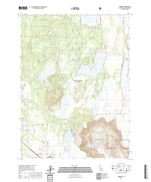
2022 Map of Ambrose
USGS Topo · Published 2022About this map
The tiny settlement of Ambrose occupies a quiet corner of the southern plateau, situated near the southwestern edge of the Modoc National Forest. This high-altitude landscape is defined by its water management and grazing infrastructure, featuring numerous catchments like Williams Reservoir, Duncan Reservoir, and Reservoir F. The terrain is characterized by broad basins and volcanic features, including the prominent rise of Rail Mtn and the expansive Sevenmile Flat. The network of forest tracks, such as Mowitz and Blacks Canyon Rd, facilitates access through the dense timber and across the meadows of Bucher Swamp. The presence of specialized ranching features like the Six-Shooter Stock Tank underscores the long-standing importance of livestock and range management in this part of northeastern California.
Find a feature on this map
18 named features on this map. Tap any name to fly to it.
Don’t see what you’re looking for? This feature index may not catch every label — zoom into the map to look around manually.
Map Details
Editions of this 2022 Ambrose Map
This is the sole edition of this map. No revisions or reprints were ever made.
Other maps of this area

1886 · Alturas
USGS Topo · 1:250,000

1886 · Modoc Lava Bed
USGS Topo · 1:250,000

1892 · Modoc Lava-Bed
USGS Topo · 1:250,000

1892 · Alturas
USGS Topo · 1:250,000

1952 · Hackamore
USGS Topo · 1:62,500

1954 · Alturas
USGS Topo · 1:250,000

1958 · Alturas
USGS Topo · 1:250,000

1961 · Canby
USGS Topo · 1:62,500

1962 · Alturas
USGS Topo · 1:250,000

1962 · Crank Mountain
USGS Topo · 1:62,500