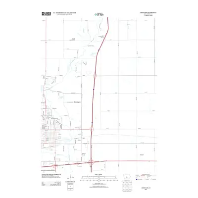
2013 Map of Ames East
USGS Topo · Published 2013About this map
Bloomington and the eastern reaches of Ames define this landscape during a period of significant regional connectivity. The S Skunk River meanders through the center of the quadrangle, crossed by the Sopers Mill Bridge and passing near agricultural research sites like the Iowa State University Experimental Farm. This area serves as a primary corridor for north-south transit, with the modern interstate bisecting the drainage basins of Keigley Br and Bear Cr. To the south, the terrain becomes more residential and recreational, featuring Homewood Golf Course and Camp Canwita. Water bodies like McFarland Lake and Arnold Lake dot the river valley, while the confluence with Squaw Cr marks the edge of the urbanized footprint, illustrating the balance between Iowa's institutional land use and its natural riparian systems.
Find a feature on this map
71 named features on this map. Tap any name to fly to it.
Don’t see what you’re looking for? This feature index may not catch every label — zoom into the map to look around manually.
Map Details
Editions of this 2013 Ames East Map
This is the sole edition of this map. No revisions or reprints were ever made.
Other maps of this area

1911 · Slater
USGS Topo · 1:62,500

1912 · Ames
USGS Topo · 1:62,500

1913 · Slater
USGS Topo · 1:62,500

1914 · Ames
USGS Topo · 1:62,500

1954 · Waterloo
USGS Topo · 1:250,000

1954 · Des Moines
USGS Topo · 1:250,000

1955 · Waterloo
USGS Topo · 1:250,000

1956 · Des Moines
USGS Topo · 1:250,000

1957 · Des Moines
USGS Topo · 1:250,000

1969 · Des Moines
USGS Topo · 1:250,000