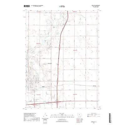
2018 Map of Ames East
USGS Topo · Published 2018About this map
Ames serves as the focal point of this eastern Story County survey, where the confluence of the South Skunk River and Squaw Creek shapes the city's topography. The landscape transitions from the developed street grids of Ames, featuring named thoroughfares like Philadelphia St and Dayton Pkwy, to the rural character of northern settlements like Bloomington. This area is particularly rich for family history research, documenting numerous burial sites including McMichael Cem, Brouhard Cem, and the Bloomington Cem. North of the city, the Sopers Mill Bridge crosses the river near McFarland Lake, reflecting the region's agricultural and recreational infrastructure. The map also captures the path of Keigley Br and Bear Cr as they feed into the larger river system, illustrating the drainage patterns vital to the surrounding township sections of t84n r24w and t84n r23w.
Find a feature on this map
74 named features on this map. Tap any name to fly to it.
Don’t see what you’re looking for? This feature index may not catch every label — zoom into the map to look around manually.
Map Details
Editions of this 2018 Ames East Map
This is the sole edition of this map. No revisions or reprints were ever made.
Other maps of this area

1911 · Slater
USGS Topo · 1:62,500

1912 · Ames
USGS Topo · 1:62,500

1913 · Slater
USGS Topo · 1:62,500

1914 · Ames
USGS Topo · 1:62,500

1954 · Waterloo
USGS Topo · 1:250,000

1954 · Des Moines
USGS Topo · 1:250,000

1955 · Waterloo
USGS Topo · 1:250,000

1956 · Des Moines
USGS Topo · 1:250,000

1957 · Des Moines
USGS Topo · 1:250,000

1969 · Des Moines
USGS Topo · 1:250,000