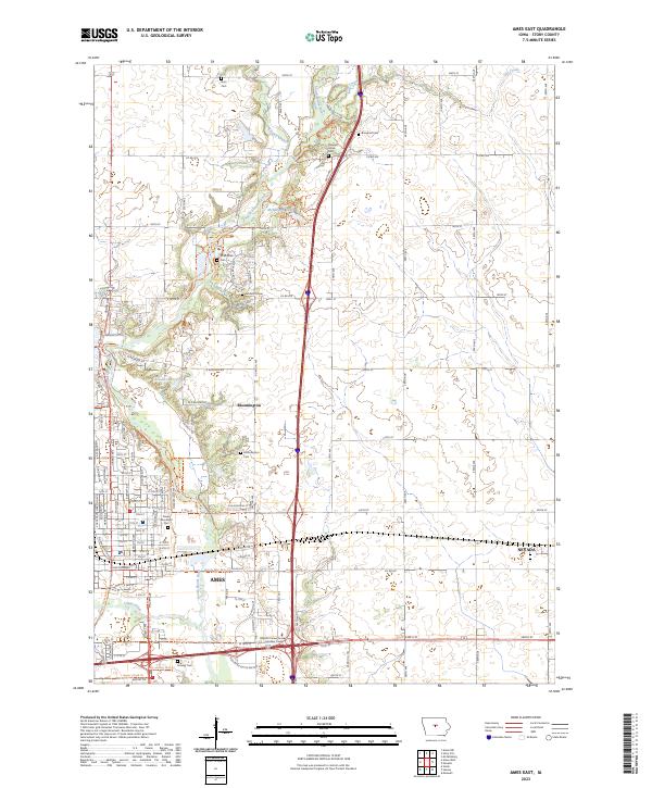
2023 Map of Ames East
USGS Topo · Published 2023About this map
The South Skunk River flows southward through this landscape, carving a corridor that includes the Skunk River Greenbelt Trl and various family-named landmarks. The eastern edges of Ames dominate the southwest, where the Ioway Creek converges with larger river systems near the DMACC Career Academy Hunziker Center. This area is characterized by its transition from the urban grid of the university city to the agricultural tracts and small settlements like Bloomington and Nevada.
Find a feature on this map
81 named features on this map. Tap any name to fly to it.
Don’t see what you’re looking for? This feature index may not catch every label — zoom into the map to look around manually.
Map Details
Editions of this 2023 Ames East Map
This is the sole edition of this map. No revisions or reprints were ever made.
Other maps of this area

1911 · Slater
USGS Topo · 1:62,500

1912 · Ames
USGS Topo · 1:62,500

1913 · Slater
USGS Topo · 1:62,500

1914 · Ames
USGS Topo · 1:62,500

1954 · Waterloo
USGS Topo · 1:250,000

1954 · Des Moines
USGS Topo · 1:250,000

1955 · Waterloo
USGS Topo · 1:250,000

1956 · Des Moines
USGS Topo · 1:250,000

1957 · Des Moines
USGS Topo · 1:250,000

1969 · Des Moines
USGS Topo · 1:250,000