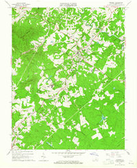
1963 Map of Amherst
USGS Topo · Published 1965About this map
Amherst and the surrounding Virginia Piedmont hills are defined by the convergence of agricultural landscapes and academic institution-building in the early 1960s. The sprawling campus of Sweet Briar College dominates the central-west portion of the sheet, connected by Rutledge Road to its own Sweet Briar Station along the Southern railroad line. This rail corridor serves as a vital artery for the region, linking smaller settlements like Faulconerville, Angelo, and Monroe.
Find a feature on this map
60 named features on this map. Tap any name to fly to it.
Don’t see what you’re looking for? This feature index may not catch every label — zoom into the map to look around manually.
Map Details
Editions of this 1963 Amherst Map
Other maps of this area

1892 · Lynchburg
USGS Topo · 1:125,000

1892 · Buckingham
USGS Topo · 1:125,000

1892 · Appomattox
USGS Topo · 1:125,000

1894 · Lexington
USGS Topo · 1:125,000

1935 · Amherst
USGS Topo · 1:48,000

1939 · Amherst
USGS Topo · 1:62,500

1944 · Lynchburg
USGS Topo · 1:62,500

1947 · Roanoke
USGS Topo · 1:250,000

1950 · Amherst
USGS Topo · 1:62,500

1950 · Lynchburg
USGS Topo · 1:62,500