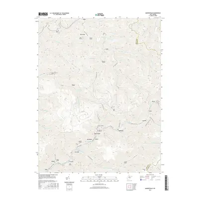
2016 Map of Amherstdale
USGS Topo · Published 2016About this map
Buffalo Creek and Rum Creek serve as the primary conduits for settlement in this coal-producing region of Logan County. The landscape is defined by tight valleys and steep ridges, where coal camp communities like Amherstdale, Accoville, and Braeholm are clustered along the narrow creek bottoms. The map reveals a dense network of family and community burial sites, including Yolyn Community Cem and White Oak Oak Cem, which are vital for genealogical research in these mountain hollows. The presence of the Rum Creek Impoundment and the winding course of Kelly Mountain Rd illustrate the human impact on the terrain. Notable peaks such as Blair Mtn and Kelly Mtn loom over the settlements, while more remote communities like Blair and Sovereign sit along the northern border near the Boone County line. These topographic details preserve the late-twentieth-century industrial and social footprint of the southern West Virginia coalfields.
Find a feature on this map
89 named features on this map. Tap any name to fly to it.
Don’t see what you’re looking for? This feature index may not catch every label — zoom into the map to look around manually.
Map Details
Editions of this 2016 Amherstdale Map
This is the sole edition of this map. No revisions or reprints were ever made.
Other maps of this area

1891 · Oceana
USGS Topo · 1:125,000

1893 · Oceana
USGS Topo · 1:125,000

1898 · Oceana
USGS Topo · 1:125,000

1909 · Gilbert
USGS Topo · 1:48,000

1910 · Pineville
USGS Topo · 1:48,000

1910 · Bald Knob
USGS Topo · 1:48,000

1912 · Bald Knob
USGS Topo · 1:62,500

1912 · Gilbert
USGS Topo · 1:62,500

1912 · Pineville
USGS Topo · 1:62,500

1913 · Logan
USGS Topo · 1:62,500