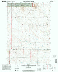
1997 Map of Amidon SE
USGS Topo · Published 2001About this map
Chalky Butte National Grassland dominates the northern landscape of this late-twentieth-century survey, where the high point of Chalky Butte rises above the surrounding plains. The map details a transition from the protected grasslands in the north to the cultivated Grain Belt in the south, reflecting the regional dependence on dryland agriculture and grazing. A sparse network of roads connects isolated landmarks, including a local Cem and a Communication Tower, which serve as vital reference points for researchers of the local community.
Find a feature on this map
16 named features on this map. Tap any name to fly to it.
Don’t see what you’re looking for? This feature index may not catch every label — zoom into the map to look around manually.
Map Details
Editions of this 1997 Amidon SE Map
This is the sole edition of this map. No revisions or reprints were ever made.
Other maps of this area

1953 · Dickinson
USGS Topo · 1:250,000

1957 · Dickinson
USGS Topo · 1:250,000

1968 · Bowman
USGS Topo · 1:24,000

1969 · Scranton
USGS Topo · 1:24,000

1973 · Black Butte
USGS Topo · 1:24,000

1973 · White Lake
USGS Topo · 1:24,000

1973 · Mineral Springs
USGS Topo · 1:24,000

1973 · Talbot Butte
USGS Topo · 1:24,000

1973 · Amidon SE
USGS Topo · 1:24,000

1973 · Stewart Lake
USGS Topo · 1:24,000