
1973 Map of Stewart Lake
USGS Topo · Published 1977About this map
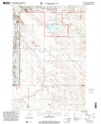
Stewart Lake National Wildlife Refuge dominates the landscape of this North Dakota borderland, centered around the waters of Stewart Lake and its associated Spillway 2853. The terrain is defined by the high elevations of Chalky Butte to the north and the expansive Cash Sheets to the south, where Deep Creek winds through the draws of the Badlands. In the early 1970s, this area remained largely defined by its natural topography and resource extraction, with numerous Gravel Pits and a Mine scattered across the undulating prairie. Human presence is concentrated near Cottage and within the townships of Marion and Star, which straddle the border between Slope and Bowman Counties. The map preserves the fine details of this rural expanse, from isolated Well locations to the distinct landform of Slope Center.
Find a feature on this map
15 named features on this map. Tap any name to fly to it.
Don’t see what you’re looking for? This feature index may not catch every label — zoom into the map to look around manually.
Map Details
Editions of this 1973 Stewart Lake Map
This is the sole edition of this map. No revisions or reprints were ever made.
Other maps of this area

1953 · Dickinson
USGS Topo · 1:250,000

1957 · Dickinson
USGS Topo · 1:250,000

1968 · Bowman
USGS Topo · 1:24,000

1973 · Black Butte
USGS Topo · 1:24,000

1973 · Talbot Butte
USGS Topo · 1:24,000

1973 · Amidon SE
USGS Topo · 1:24,000

1973 · Amidon
USGS Topo · 1:24,000

1973 · Griffin
USGS Topo · 1:24,000

1981 · Bowman
USGS Topo · 1:100,000
1997 · Stewart Lake
USGS Topo · 1:24,000