
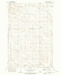
1973 Map of Griffin
USGS Topo · Published 1977About this map
The high plains of southwestern North Dakota are documented here in the early 1970s, defined by the prominent Medicine Pole Hills and a network of ephemeral watercourses. The settlement of Griffin serves as a small rail hub along the Chicago Milwaukee St Paul and Pacific railroad, which cuts across the northern half of the landscape. The map reveals the area's industrial leanings through numerous extractive sites, including several Scoria Pits and Gravel Pits concentrated near the rail line and along the township boundaries of Marion, Hart, Adelaide, and Rhame. Natural drainage is provided by Turkey Creek, Cold Spring Creek, and Alkali Creek, which snake through the coulees and draws typical of Bowman County's topography. The detailed surveying captures the intersection of the railroad economy with the rural ranching landscape, highlighted by numerous springs and windmills scattered across the open range.
Find a feature on this map
15 named features on this map. Tap any name to fly to it.
Don’t see what you’re looking for? This feature index may not catch every label — zoom into the map to look around manually.
Map Details
Editions of this 1973 Griffin Map
This is the sole edition of this map. No revisions or reprints were ever made.
Other maps of this area

1953 · Dickinson
USGS Topo · 1:250,000

1957 · Dickinson
USGS Topo · 1:250,000

1968 · Bowman SW
USGS Topo · 1:24,000

1968 · Bowman
USGS Topo · 1:24,000

1973 · Camel Butte
USGS Topo · 1:24,000
1973 · Rhame SE
USGS Topo · 1:24,000

1973 · Stewart Lake
USGS Topo · 1:24,000

1973 · Rhame
USGS Topo · 1:24,000

1979 · Ives
USGS Topo · 1:24,000

1981 · Bowman
USGS Topo · 1:100,000