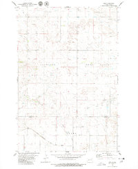
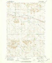
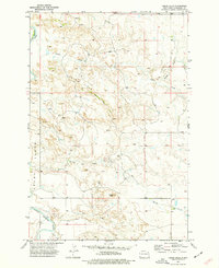
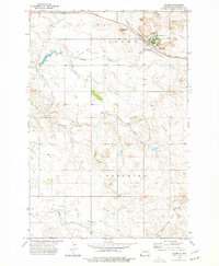
1979 Map of Ives
USGS Topo · Published 1980About this map
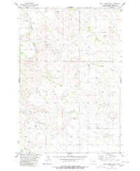
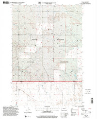
The boundary between Slope Co and Bowman Co defines the southern portion of this landscape, where the Chicago Milwaukee St Paul and Pacific railroad cuts through the prairie. Near the tracks, the settlement of Ives and scattered storage bins mark the local agricultural economy during the late 1970s. The terrain is characterized by broad uplands like Crawford and Deep Creek, which are drained by a network of waterways including Cash Creek, Indian Creek, and Bacon Creek. Genealogists and local historians will find the St Paul Cem located north of the railroad, serving as a landmark for the community that once centered around these rail sidings. Small-scale resource extraction is also evident at several gravel pits found near the township lines and watercourses.
Find a feature on this map
14 named features on this map. Tap any name to fly to it.
Don’t see what you’re looking for? This feature index may not catch every label — zoom into the map to look around manually.
Map Details
Editions of this 1979 Ives Map
This is the sole edition of this map. No revisions or reprints were ever made.
Other maps of this area

1953 · Dickinson
USGS Topo · 1:250,000

1957 · Dickinson
USGS Topo · 1:250,000
1973 · Griffin
USGS Topo · 1:24,000
1973 · Cedar Hills
USGS Topo · 1:24,000
1973 · Rhame
USGS Topo · 1:24,000
1980 · Boyce Creek West
USGS Topo · 1:24,000
1981 · Bowman
USGS Topo · 1:100,000
1997 · Boyce Creek West
USGS Topo · 1:24,000
1997 · Marmarth SE
USGS Topo · 1:24,000
1997 · Ives
USGS Topo · 1:24,000