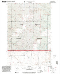
1997 Map of Ives
USGS Topo · Published 2001About this map
The Little Missouri National Grassland dominates this corner of the North Dakota badlands, where the high plains break into the drainage basins of Cash Creek and the West Fork Deep Creek. This landscape is defined by its ranching history, evidenced by family-named operations like Fischer Ranch, E Fischer Ranch, and Swenson Ranch. The southern portion of the quadrangle marks the border between Slope County and Bowman County, with the community of Ives situated along the tracks of the Burlington Northern Santa Fe railroad.
Find a feature on this map
23 named features on this map. Tap any name to fly to it.
Don’t see what you’re looking for? This feature index may not catch every label — zoom into the map to look around manually.
Map Details
Editions of this 1997 Ives Map
This is the sole edition of this map. No revisions or reprints were ever made.
Other maps of this area

1953 · Dickinson
USGS Topo · 1:250,000

1957 · Dickinson
USGS Topo · 1:250,000

1973 · Griffin
USGS Topo · 1:24,000

1973 · Cedar Hills
USGS Topo · 1:24,000

1973 · Rhame
USGS Topo · 1:24,000

1979 · Ives
USGS Topo · 1:24,000

1980 · Boyce Creek West
USGS Topo · 1:24,000

1981 · Bowman
USGS Topo · 1:100,000
1997 · Boyce Creek West
USGS Topo · 1:24,000
1997 · Marmarth SE
USGS Topo · 1:24,000