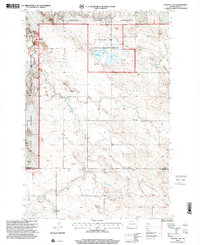
1997 Map of Stewart Lake
USGS Topo · Published 2001About this map
Stewart Lake National Wildlife Refuge anchors this northern Great Plains landscape, centered on the waters of Stewart Lake and its associated spillway. The map captures a high-plateau environment defined by drainage systems like Deep Creek and the East Fork Deep Creek, which carve through the open range. The terrain is marked by significant landforms such as Chalk Butte and named areas like Star and Cash Sheets, reflecting the specialized nomenclature of local ranching and land use.
Find a feature on this map
18 named features on this map. Tap any name to fly to it.
Don’t see what you’re looking for? This feature index may not catch every label — zoom into the map to look around manually.
Map Details
Editions of this 1997 Stewart Lake Map
This is the sole edition of this map. No revisions or reprints were ever made.
Other maps of this area

1953 · Dickinson
USGS Topo · 1:250,000

1957 · Dickinson
USGS Topo · 1:250,000

1968 · Bowman
USGS Topo · 1:24,000

1973 · Black Butte
USGS Topo · 1:24,000

1973 · Talbot Butte
USGS Topo · 1:24,000

1973 · Amidon SE
USGS Topo · 1:24,000

1973 · Stewart Lake
USGS Topo · 1:24,000

1973 · Amidon
USGS Topo · 1:24,000

1973 · Griffin
USGS Topo · 1:24,000

1981 · Bowman
USGS Topo · 1:100,000