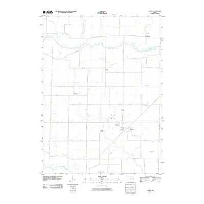
2010 Map of Amish
USGS Topo · Published 2010About this map
Old Mans Creek meanders across the northern portion of this Johnson County landscape, defining a rural corridor that connects the settlement of Windham with the surrounding agricultural grid. This region is characterized by a high density of small, family-named burial grounds and community landmarks, reflecting a deep-rooted lineage of local settlement. Further south, the community of Amish sits near the intersection of Angle Rd SW and 550th St SW, serving as a focal point for the surrounding farmsteads. The land is bounded to the south by the English River, while several tributaries like Birch Creek and Schaffer Creek drain the fertile terrain. The presence of numerous sites such as West Union Cemetery, Shetler Cemetery, and Brenneman Cemetery provides a clear spatial record of early families and established rural congregations across the township.
Find a feature on this map
52 named features on this map. Tap any name to fly to it.
Don’t see what you’re looking for? This feature index may not catch every label — zoom into the map to look around manually.
Map Details
Editions of this 2010 Amish Map
This is the sole edition of this map. No revisions or reprints were ever made.
Other maps of this area

1891 · Oxford
USGS Topo · 1:62,500

1891 · Iowa City
USGS Topo · 1:62,500

1894 · Oxford
USGS Topo · 1:62,500

1903 · Fairfax
USGS Topo · 1:125,000

1938 · Iowa City
USGS Topo · 1:62,500

1958 · Davenport
USGS Topo · 1:250,000

1961 · Davenport
USGS Topo · 1:250,000

1962 · Davenport
USGS Topo · 1:250,000

1965 · Williamstown
USGS Topo · 1:24,000
1965 · Tiffin
USGS Topo · 1:24,000