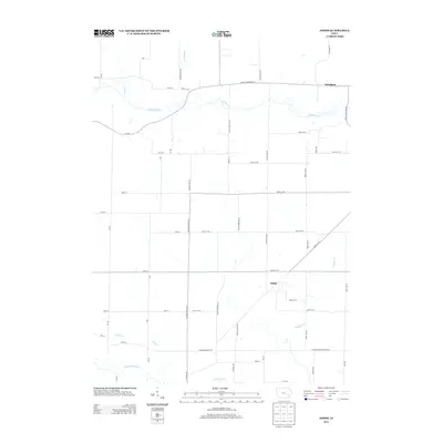
2013 Map of Amish
USGS Topo · Published 2013About this map
The English River flows across the southern reaches of this Johnson County landscape, anchoring a rural topography defined by small settlements and winding waterways. The community of Amish sits centrally, while Windham is positioned in the northeastern corner, illustrating the dispersed settlement patterns typical of this part of Iowa. The terrain is intricately drained by several tributaries, including Old Mans Cr, Mooney Cr, Schaffer Cr, and Birch Cr, which carve paths through the agricultural grid. A network of local roads and trails, such as Black Diamond Rd Sw and the Orval Yoder Tpke Sw, connects these rural outposts. The map reveals the persistence of traditional land use and naming conventions, providing a clear view of the intersection between natural drainage and human habitation in the early 21st century.
Find a feature on this map
51 named features on this map. Tap any name to fly to it.
Don’t see what you’re looking for? This feature index may not catch every label — zoom into the map to look around manually.
Map Details
Editions of this 2013 Amish Map
This is the sole edition of this map. No revisions or reprints were ever made.
Other maps of this area

1891 · Oxford
USGS Topo · 1:62,500

1891 · Iowa City
USGS Topo · 1:62,500

1894 · Oxford
USGS Topo · 1:62,500

1903 · Fairfax
USGS Topo · 1:125,000

1938 · Iowa City
USGS Topo · 1:62,500

1958 · Davenport
USGS Topo · 1:250,000

1961 · Davenport
USGS Topo · 1:250,000

1962 · Davenport
USGS Topo · 1:250,000

1965 · Williamstown
USGS Topo · 1:24,000
1965 · Tiffin
USGS Topo · 1:24,000