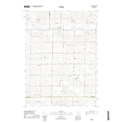
2018 Map of Amish
USGS Topo · Published 2018About this map
Amish and Windham anchor this agricultural landscape at the border of Johnson and Washington counties. The settlement pattern is defined by a dense network of local cemeteries, suggesting deep genealogical roots across the countryside, including Windham Cem, Bethel Cem, and West Union Cem. Numerous smaller burial sites like Shetler Cem and Brenneman Cem are interspersed among the farms, providing essential landmarks for local history researchers.
Find a feature on this map
50 named features on this map. Tap any name to fly to it.
Don’t see what you’re looking for? This feature index may not catch every label — zoom into the map to look around manually.
Map Details
Editions of this 2018 Amish Map
This is the sole edition of this map. No revisions or reprints were ever made.
Other maps of this area

1891 · Oxford
USGS Topo · 1:62,500

1891 · Iowa City
USGS Topo · 1:62,500

1894 · Oxford
USGS Topo · 1:62,500

1903 · Fairfax
USGS Topo · 1:125,000

1938 · Iowa City
USGS Topo · 1:62,500

1958 · Davenport
USGS Topo · 1:250,000

1961 · Davenport
USGS Topo · 1:250,000

1962 · Davenport
USGS Topo · 1:250,000

1965 · Williamstown
USGS Topo · 1:24,000
1965 · Tiffin
USGS Topo · 1:24,000