
1971 Map of Amistad SE
USGS Topo · Published 1973About this map
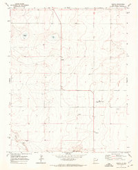
Centerville sits as a quiet hub in this high plains landscape at the New Mexico and Texas border, where the 1971 terrain is defined by its vital water sources and vast cattle-ranching acreage. The map records a network of named water points essential to life here, including the Poteet Well, Moore Well, and Whatley Well, alongside an unnamed Cem that provides a key genealogical marker for the area. The drainage patterns are clearly mapped, with Monia Creek and Cramer Creek cutting through the arid land while Fullingim Draw winds toward the south. Rising above the draws, High Lonesome Hill serves as a prominent landmark in the corner of Union Co and Hartley Co, illustrating the sparse but deliberate human footprint on this borderland environment during the early 1970s.
Find a feature on this map
23 named features on this map. Tap any name to fly to it.
Don’t see what you’re looking for? This feature index may not catch every label — zoom into the map to look around manually.
Map Details
Editions of this 1971 Amistad SE Map
This is the sole edition of this map. No revisions or reprints were ever made.
Other maps of this area

1954 · Tucumcari
USGS Topo · 1:250,000

1958 · Tucumcari
USGS Topo · 1:250,000

1971 · Kerlin Hill
USGS Topo · 1:24,000

1971 · Koger Ranch
USGS Topo · 1:24,000

1971 · Centerville Corner
USGS Topo · 1:24,000

1971 · Doyle Hill
USGS Topo · 1:24,000

1971 · Beck Ranch
USGS Topo · 1:24,000
1971 · Amistad
USGS Topo · 1:24,000

1971 · Whiteaker Ranch
USGS Topo · 1:24,000
1971 · Romero
USGS Topo · 1:24,000