
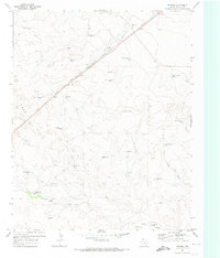
1971 Map of Doyle Hill
USGS Topo · Published 1973About this map
Chicago Rock Island and Pacific railroad tracks cut a diagonal path across this high plains borderland, where the tri-county corners of Union, Quay, and Hartley meet. The landscape is defined by its water management, evidenced by numerous named ranching features like Patterson Well, Millican Well, and the Dirt Tank. To the east, the Sand Hills rise near the New Mexico Texas state line, creating a distinct topographical contrast with the drainage basins of Minneosa Creek and Arroyo Nara Visa.
Find a feature on this map
34 named features on this map. Tap any name to fly to it.
Don’t see what you’re looking for? This feature index may not catch every label — zoom into the map to look around manually.
Map Details
Editions of this 1971 Doyle Hill Map
This is the sole edition of this map. No revisions or reprints were ever made.
Other maps of this area

1954 · Tucumcari
USGS Topo · 1:250,000

1958 · Tucumcari
USGS Topo · 1:250,000

1971 · Kerlin Hill
USGS Topo · 1:24,000

1971 · Centerville Corner
USGS Topo · 1:24,000

1971 · Amistad SE
USGS Topo · 1:24,000

1971 · Obar
USGS Topo · 1:24,000

1971 · Nara Visa
USGS Topo · 1:24,000

1971 · Whiteaker Ranch
USGS Topo · 1:24,000

1971 · Knoblaw
USGS Topo · 1:24,000
1971 · Romero
USGS Topo · 1:24,000