
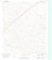
1971 Map of Nara Visa
USGS Topo · Published 1973About this map
Nara Visa serves as the focal point of this 1971 survey, situated along the Chicago Rock Island and Pacific railroad line near the New Mexico and Texas state line. The settlement pattern is defined by the high plains ranching economy, where numerous named water sources such as Jones Well, McAlister Well, and Houghton Well indicate the critical infrastructure required for livestock in this arid environment. The terrain transitions from the relatively flat expanses near Bravo Ranch to the more dissected landscapes of Sidle Canyon and the Nara Visa Arroyo. These drainage systems, including the North Fork and South Fork, dictate the placement of roads like Lockney Road. This map documents a period when the rail line remained a vital artery through Quay County, connecting remote ranching outposts to larger markets.
Find a feature on this map
43 named features on this map. Tap any name to fly to it.
Don’t see what you’re looking for? This feature index may not catch every label — zoom into the map to look around manually.
Map Details
Editions of this 1971 Nara Visa Map
This is the sole edition of this map. No revisions or reprints were ever made.
Other maps of this area

1954 · Tucumcari
USGS Topo · 1:250,000

1958 · Tucumcari
USGS Topo · 1:250,000

1966 · Trujillo Camp
USGS Topo · 1:24,000

1968 · Cammak Camp
USGS Topo · 1:24,000

1968 · Sanchez Springs
USGS Topo · 1:24,000

1971 · Kerlin Hill
USGS Topo · 1:24,000

1971 · Doyle Hill
USGS Topo · 1:24,000

1971 · Obar
USGS Topo · 1:24,000

1971 · Knoblaw
USGS Topo · 1:24,000
1971 · Romero
USGS Topo · 1:24,000