
1968 Map of Cammak Camp
USGS Topo · Published 1971About this map
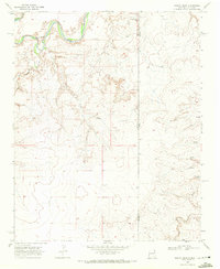
The Canadian River meanders through the southern portion of this landscape, carving a distinct corridor through the arid Quay County plains. In the late 1960s, the region was defined by a vast network of water infrastructure critical for ranching, centered around named hubs like Cammak Camp and Collins Camp. The map documents numerous family and ranch-named water sources, including Flag Ranch Well, Schoonermaker Well, and Ditterline Well, which illustrate the spread of land use across the township. To the north, Sager Draw cuts across the terrain near several Jeep trails, while an area of Shifting Sand near the eastern boundary reveals the active nature of the local geography. This survey provides a precise look at the rural economy of the era, where survival and settlement were tethered to these specific, named groundwater points.
Find a feature on this map
26 named features on this map. Tap any name to fly to it.
Don’t see what you’re looking for? This feature index may not catch every label — zoom into the map to look around manually.
Map Details
Editions of this 1968 Cammak Camp Map
This is the sole edition of this map. No revisions or reprints were ever made.
Other maps of this area

1954 · Tucumcari
USGS Topo · 1:250,000

1958 · Tucumcari
USGS Topo · 1:250,000

1962 · Logan
USGS Topo · 1:62,500

1966 · Lockney
USGS Topo · 1:24,000

1968 · Blue Hole
USGS Topo · 1:24,000

1968 · Sanchez Springs
USGS Topo · 1:24,000
1968 · Martin Draw
USGS Topo · 1:24,000

1971 · Obar
USGS Topo · 1:24,000

1971 · Nara Visa
USGS Topo · 1:24,000
1989 · Tuscocoillo Canyon
USGS Topo · 1:24,000