
1966 Map of Lockney
USGS Topo · Published 1969About this map
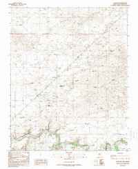
Lockney (Site) serves as a primary marker in this high plains landscape of Quay County, illustrating the sparse settlement patterns of eastern New Mexico in the mid-1960s. The region is defined by an extensive network of named water sources and drainage features, including Shallow Well Draw, Butler Draw, and Saggert Draw, which were essential for ranching operations. The presence of numerous wells bearing family names, such as Willis Well, Keyes Well, Frampton Well, and Brice Well, highlights the genealogy of local landholders and the vital importance of groundwater. Transportation in the area relies on a grid of unimproved routes like Lockney Road and Obar Road, while a Jeep Trail and various fence lines suggest the working nature of this rural terrain. This survey provides a clear view of the ranching infrastructure before modern developments, preserving the locations of historical cattle tanks and homestead sites.
Find a feature on this map
27 named features on this map. Tap any name to fly to it.
Don’t see what you’re looking for? This feature index may not catch every label — zoom into the map to look around manually.
Map Details
Editions of this 1966 Lockney Map
This is the sole edition of this map. No revisions or reprints were ever made.
Other maps of this area

1954 · Tucumcari
USGS Topo · 1:250,000

1958 · Tucumcari
USGS Topo · 1:250,000

1962 · Logan
USGS Topo · 1:62,500

1966 · Cherokee Valley
USGS Topo · 1:24,000

1966 · Mc Carty Ranch
USGS Topo · 1:24,000

1966 · Mc Cloy Ranch
USGS Topo · 1:24,000

1968 · Cammak Camp
USGS Topo · 1:24,000

1971 · Kerlin Hill
USGS Topo · 1:24,000

1971 · Obar
USGS Topo · 1:24,000
1989 · Logan NE
USGS Topo · 1:24,000