
1968 Map of Bulldog Mesa
USGS Topo · Published 1971About this map
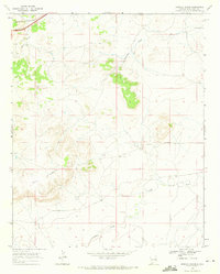
Bulldog Mesa and the prominent Mesa Redonda dominate the landscape of this Quay County region during the late 1960s. The map illustrates a rural ranching economy where named homesteads such as Owens Ranch and Fife Ranch are connected by a network of unimproved roads and fence lines. This era shows the critical role of water management in the high plains, evidenced by the presence of the Conchas Canal, Savage Lateral, and Regulator Reservoir No 2. Local history and genealogy interests are anchored by small, isolated burial sites including Newhome Cem and Apodaca Cem. The drainage patterns of Plaza Larga Creek and Apodaca Creek define the local topography, carving through the terrain between the mesas and providing a lifeline for the cattle operations and sparse settlements throughout the quadrangle.
Find a feature on this map
22 named features on this map. Tap any name to fly to it.
Don’t see what you’re looking for? This feature index may not catch every label — zoom into the map to look around manually.
Map Details
Editions of this 1968 Bulldog Mesa Map
This is the sole edition of this map. No revisions or reprints were ever made.
Other maps of this area

1930 · Tucumcari
USGS Topo · 1:125,000

1954 · Tucumcari
USGS Topo · 1:250,000

1954 · Clovis
USGS Topo · 1:250,000

1958 · Clovis
USGS Topo · 1:250,000

1958 · Tucumcari
USGS Topo · 1:250,000

1967 · Liberty Mesa
USGS Topo · 1:24,000

1967 · Tucumcari
USGS Topo · 1:24,000

1968 · Lesbia
USGS Topo · 1:24,000
1968 · Briscoe Ranch
USGS Topo · 1:24,000
1968 · Tucumcari SE
USGS Topo · 1:24,000