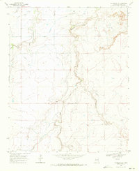
1968 Map of Tucumcari SE
USGS Topo · Published 1971About this map
The arid high plains of Quay County are defined by an extensive network of irrigation infrastructure in the late 1960s. Water management dominates the landscape, where the Conchas Canal feeds a complex series of watercourses including the Conchas Elevated Lateral, Farrow Lateral, and Thomas Lateral. These engineering works were essential for sustaining life and agriculture in a region dissected by ephemeral drainage systems like Plaza Larga Creek and Barranca Creek.
Find a feature on this map
13 named features on this map. Tap any name to fly to it.
Don’t see what you’re looking for? This feature index may not catch every label — zoom into the map to look around manually.
Map Details
Editions of this 1968 Tucumcari SE Map
This is the sole edition of this map. No revisions or reprints were ever made.
Other maps of this area

1930 · Tucumcari
USGS Topo · 1:125,000

1954 · Tucumcari
USGS Topo · 1:250,000

1954 · Clovis
USGS Topo · 1:250,000

1958 · Clovis
USGS Topo · 1:250,000

1958 · Tucumcari
USGS Topo · 1:250,000

1967 · Tucumcari
USGS Topo · 1:24,000

1968 · Bulldog Mesa
USGS Topo · 1:24,000

1968 · San Jon NW
USGS Topo · 1:24,000

1968 · Lesbia
USGS Topo · 1:24,000

1968 · Bedford Hill
USGS Topo · 1:24,000