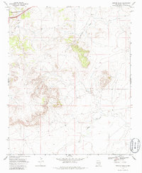
1968 Map of Briscoe Ranch
USGS Topo · Published 1986About this map
Briscoe Ranch serves as a central landmark in this high plains landscape of Quay County, where the terrain is defined by the drainage networks of Plaza Larga Creek and Bluewater Creek. In the late 1960s, the northwestern corner of the area was dominated by the infrastructure of the Chicago Rock Island and Pacific railroad, which passed near the settlement of Palomas. This transit corridor contrasts with the more isolated interior of the quadrangle, where a Jeep Trail provides the primary means of navigating the arid rangeland. The presence of remote outposts like Corral and water sources such as Dyer Well underscores the importance of ranching and livestock management in this part of eastern New Mexico, where deep arroyos and wide creek beds carve through the mesa country.
Find a feature on this map
10 named features on this map. Tap any name to fly to it.
Don’t see what you’re looking for? This feature index may not catch every label — zoom into the map to look around manually.
Map Details
Editions of this 1968 Briscoe Ranch Map
2 editions found
Other maps of this area

1930 · Tucumcari
USGS Topo · 1:125,000

1954 · Tucumcari
USGS Topo · 1:250,000

1954 · Clovis
USGS Topo · 1:250,000

1958 · Clovis
USGS Topo · 1:250,000

1958 · Tucumcari
USGS Topo · 1:250,000

1967 · Liberty Mesa
USGS Topo · 1:24,000

1967 · Tucumcari
USGS Topo · 1:24,000
1968 · Quemado Hills
USGS Topo · 1:24,000

1968 · Bulldog Mesa
USGS Topo · 1:24,000
1968 · Cow Canyon
USGS Topo · 1:24,000