
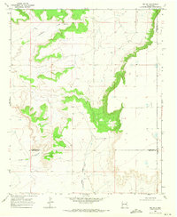
1968 Map of Hassell
USGS Topo · Published 1971About this map
Gerhardt Valley defines this section of the High Plains, where the drainage of Truchas Creek meets the dramatic escarpment of Lone Mesa. Surveyed in the late 1960s, the landscape is characterized by a sparse ranching economy, with family-named operations like Urton Ranch, Parmer Ranch, and Ballew Ranch scattered across the open range. The small settlement of Hassell sits on the plateau, serving as a central point for this rural community. Genealogists and local historians will find significant value in the preservation of several small burial grounds, including the Lone Mesa Cem, Gerhardt Cem, and House Cem. The terrain is shaped by the winding path of Alamosa Creek in the north, showing the relationship between water sources and early New Mexico land use in Quay County.
Find a feature on this map
11 named features on this map. Tap any name to fly to it.
Don’t see what you’re looking for? This feature index may not catch every label — zoom into the map to look around manually.
Map Details
Editions of this 1968 Hassell Map
This is the sole edition of this map. No revisions or reprints were ever made.
Other maps of this area

1954 · Fort Sumner
USGS Topo · 1:250,000

1954 · Clovis
USGS Topo · 1:250,000

1958 · Fort Sumner
USGS Topo · 1:250,000

1958 · Clovis
USGS Topo · 1:250,000

1968 · Twin Mesa NW
USGS Topo · 1:24,000

1968 · Ima SE
USGS Topo · 1:24,000

1968 · Candy Mesa
USGS Topo · 1:24,000

1968 · Twin Mesa
USGS Topo · 1:24,000
1968 · Ima SW
USGS Topo · 1:24,000
1970 · Cunavea Basin
USGS Topo · 1:24,000