
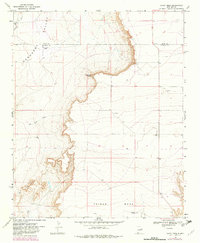
1968 Map of Candy Mesa
USGS Topo · Published 1971About this map
Gerhardt Valley and the surrounding high plains of East-Central New Mexico are defined here by dramatic escarpments and isolated ranching outposts in the late 1960s. The landscape is characterized by the stark transition from the floor of the valley up the steep, multi-contoured slopes of Charlotte Point and the expansive Taiban Mesa. This period of land use is marked by scattered improvements such as the Knighten Ranch and M and M Ranch, which represent the enduring cattle-ranching heritage of the Quay and De Baca county border region. Seasonal drainage is evident through Truchas Creek and Red Tank Creek, while the presence of Gravel Pits and a solitary Drill Hole point to the area's mineral and water exploration efforts on the edge of Candy Mesa.
Find a feature on this map
11 named features on this map. Tap any name to fly to it.
Don’t see what you’re looking for? This feature index may not catch every label — zoom into the map to look around manually.
Map Details
Editions of this 1968 Candy Mesa Map
2 editions found
Other maps of this area

1954 · Fort Sumner
USGS Topo · 1:250,000

1954 · Clovis
USGS Topo · 1:250,000

1958 · Fort Sumner
USGS Topo · 1:250,000

1958 · Clovis
USGS Topo · 1:250,000

1968 · Hassell
USGS Topo · 1:24,000

1968 · Twin Mesa NW
USGS Topo · 1:24,000

1968 · Fort Sumner East
USGS Topo · 1:24,000

1968 · Taiban
USGS Topo · 1:24,000

1968 · Twin Mesa
USGS Topo · 1:24,000

1973 · Tolar
USGS Topo · 1:24,000