
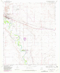
1968 Map of Fort Sumner East
USGS Topo · Published 1971About this map
The Pecos River carves through the heart of the Fort Sumner Valley in this late 1960s survey, illustrating a landscape defined by both natural watercourses and significant irrigation engineering. The Fort Sumner Main Canal parallels the river, feeding the agricultural lands surrounding the town of Fort Sumner. This era shows the critical transportation corridor of the Atchison Topeka and Santa Fe railroad cutting east-west across the terrain, passing through the small settlement of La Lande. Genealogists will find particular value in the documentation of three distinct burial grounds: the Fort Sumner Cem, the La Lande Cem, and the Old Ft Sumner Cem located further south near a Pumping Sta. The presence of the Fort Sumner Airport and numerous Gravel Pits reflects the mid-century infrastructure and industrial activity of De Baca County.
Find a feature on this map
23 named features on this map. Tap any name to fly to it.
Don’t see what you’re looking for? This feature index may not catch every label — zoom into the map to look around manually.
Map Details
Editions of this 1968 Fort Sumner East Map
2 editions found
Other maps of this area

1954 · Fort Sumner
USGS Topo · 1:250,000

1958 · Fort Sumner
USGS Topo · 1:250,000

1965 · Fort Sumner West
USGS Topo · 1:24,000

1965 · Windmill Draw
USGS Topo · 1:24,000

1966 · Alamo Ranch
USGS Topo · 1:24,000

1968 · Lomas Gatos
USGS Topo · 1:24,000

1968 · Candy Mesa
USGS Topo · 1:24,000

1968 · Taiban
USGS Topo · 1:24,000

1968 · Bonner Lake
USGS Topo · 1:24,000

1968 · Twin Mesa
USGS Topo · 1:24,000