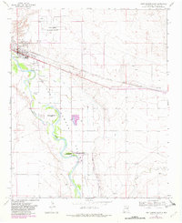
1968 Map of Fort Sumner East
USGS Topo · Published 1982About this map
Pecos River valley irrigation and historical preservation define this eastern New Mexico landscape, dominated by the curving river and its significant Fort Sumner Main Canal. The town of Fort Sumner serves as a local hub near the Atchison Topeka and Santa Fe railroad, while the surrounding area maintains deep ties to 19th-century history. The Fort Sumner State Monument and Bosque Redondo Park mark the site of the Bosque Redondo Reservation, a site of profound importance in Navajo and Mescalero Apache history. Notable for genealogists are the three distinct burial grounds: Fort Sumner Cem, La Lande Cem, and the Old Ft Sumner Cem. The map also captures the infrastructure of the late 1960s, including the Fort Sumner Municipal Airport and smaller settlements like La Lande.
Find a feature on this map
26 named features on this map. Tap any name to fly to it.
Don’t see what you’re looking for? This feature index may not catch every label — zoom into the map to look around manually.
Map Details
Editions of this 1968 Fort Sumner East Map
2 editions found
Other maps of this area

1954 · Fort Sumner
USGS Topo · 1:250,000

1958 · Fort Sumner
USGS Topo · 1:250,000

1965 · Fort Sumner West
USGS Topo · 1:24,000

1965 · Windmill Draw
USGS Topo · 1:24,000

1966 · Alamo Ranch
USGS Topo · 1:24,000

1968 · Lomas Gatos
USGS Topo · 1:24,000

1968 · Fort Sumner East
USGS Topo · 1:24,000

1968 · Candy Mesa
USGS Topo · 1:24,000

1968 · Taiban
USGS Topo · 1:24,000

1968 · Bonner Lake
USGS Topo · 1:24,000