
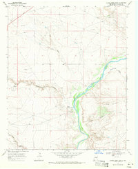
1966 Map of Alamo Ranch
USGS Topo · Published 1968About this map
Alamo Ranch sits in the high plateau country of De Baca County, where the landscape is defined by the vital network of water infrastructure required for cattle ranching. During the mid-1960s, the region was sparsely populated, with life revolving around the scattered water sources and the Atchison Topeka and Santa Fe railroad corridor. The map reveals an intricate system of family-named or location-specific wells and tanks, such as Pennington Well and Altito Windmill, which sustained the ranching economy across this arid terrain.
Find a feature on this map
20 named features on this map. Tap any name to fly to it.
Don’t see what you’re looking for? This feature index may not catch every label — zoom into the map to look around manually.
Map Details
Editions of this 1966 Alamo Ranch Map
This is the sole edition of this map. No revisions or reprints were ever made.
Other maps of this area

1954 · Fort Sumner
USGS Topo · 1:250,000

1958 · Fort Sumner
USGS Topo · 1:250,000

1965 · Fort Sumner West
USGS Topo · 1:24,000

1966 · West Camp
USGS Topo · 1:24,000

1966 · Ricardo
USGS Topo · 1:24,000

1967 · Eighteenmile Hill
USGS Topo · 1:24,000

1967 · Conejo Creek West
USGS Topo · 1:24,000
1967 · Conejo Creek East
USGS Topo · 1:24,000

1968 · Fort Sumner East
USGS Topo · 1:24,000

1968 · Bonner Lake
USGS Topo · 1:24,000