
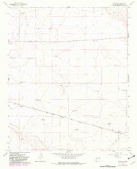
1966 Map of Ricardo
USGS Topo · Published 1968About this map
Ricardo and the smaller siding of Evanola anchor this high-plains landscape in De Baca County, defined by the steady transit of the Atchison Topeka and Santa Fe railway. The tracks cut a diagonal path through the southeastern terrain, supporting a local economy dependent on groundwater and ranching. The sheer number of named landmarks like Bertie Windmill, My Windmill, and the Railroad Windmill underscores the critical importance of water infrastructure for cattle and the steam-era rail heritage that built these settlements.
Find a feature on this map
19 named features on this map. Tap any name to fly to it.
Don’t see what you’re looking for? This feature index may not catch every label — zoom into the map to look around manually.
Map Details
Editions of this 1966 Ricardo Map
2 editions found
Other maps of this area

1954 · Fort Sumner
USGS Topo · 1:250,000

1958 · Fort Sumner
USGS Topo · 1:250,000

1965 · Fort Sumner West
USGS Topo · 1:24,000

1965 · Windmill Draw
USGS Topo · 1:24,000

1966 · West Camp
USGS Topo · 1:24,000

1966 · Alamo Ranch
USGS Topo · 1:24,000

1966 · Alamogordo Dam
USGS Topo · 1:24,000

1966 · Cooper Ranch
USGS Topo · 1:24,000

1966 · Horney Ranch
USGS Topo · 1:24,000

1966 · Yeso
USGS Topo · 1:24,000