
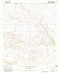
1966 Map of West Camp
USGS Topo · Published 1968About this map
The Weston Ranch and scattered outposts like North Camp and West Camp define the ranching character of this De Baca County landscape in the mid-1960s. The topography is dominated by the broad elevation of Conejo Mesa to the south, which gives way to a network of drainage systems including Guana Draw and Yeso Creek. The presence of features like the Lower End Windmill and various water tanks across the high plains underscores the critical importance of water management for livestock in this arid environment.
Find a feature on this map
14 named features on this map. Tap any name to fly to it.
Don’t see what you’re looking for? This feature index may not catch every label — zoom into the map to look around manually.
Map Details
Editions of this 1966 West Camp Map
2 editions found
Other maps of this area

1954 · Fort Sumner
USGS Topo · 1:250,000

1958 · Fort Sumner
USGS Topo · 1:250,000

1965 · Fort Sumner West
USGS Topo · 1:24,000

1966 · Alamo Ranch
USGS Topo · 1:24,000

1966 · Ricardo
USGS Topo · 1:24,000

1966 · Horney Ranch
USGS Topo · 1:24,000

1966 · Yeso
USGS Topo · 1:24,000

1967 · Dunlap NE
USGS Topo · 1:24,000

1967 · Conejo Creek West
USGS Topo · 1:24,000
1967 · Conejo Creek East
USGS Topo · 1:24,000