
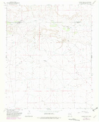
1966 Map of Cooper Ranch
USGS Topo · Published 1969About this map
Salado Creek cuts through the northern reach of this landscape, marking a prominent corridor of activity on the border of Guadalupe and De Baca counties. The high plains of this region are characterized by isolated ranching infrastructure and evidence of earlier habitations. Notable landmarks include the Cooper Ranch and several sites marked simply as Ruins, which offer a look at the scattered settlement patterns of the mid-1960s. Water management is a primary theme of the terrain, visible through features like the Upper Wagon Windmill, various Water Tanks, and a Spring. The presence of a small Cem near the creek provides a specific point of interest for genealogists tracing local families from this era of New Mexico ranching history.
Find a feature on this map
9 named features on this map. Tap any name to fly to it.
Don’t see what you’re looking for? This feature index may not catch every label — zoom into the map to look around manually.
Map Details
Editions of this 1966 Cooper Ranch Map
2 editions found
Other maps of this area

1954 · Fort Sumner
USGS Topo · 1:250,000

1958 · Fort Sumner
USGS Topo · 1:250,000

1966 · Gibbons Ranch
USGS Topo · 1:24,000

1966 · Ricardo
USGS Topo · 1:24,000

1966 · Ojo Negro Creek
USGS Topo · 1:24,000

1966 · Alamogordo Dam
USGS Topo · 1:24,000

1966 · Borica SW
USGS Topo · 1:24,000

1966 · Yeso
USGS Topo · 1:24,000

1966 · Yeso NW
USGS Topo · 1:24,000

1966 · Borica
USGS Topo · 1:24,000