
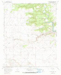
1966 Map of Ojo Negro Creek
USGS Topo · Published 1969About this map
The Pecos River carves through this Guadalupe County landscape, feeding into the northern reaches of the Alamogordo Reservoir. The topography is defined by significant drainage systems, including Ojo Negro Creek and the sweeping Borica Draw, which transition from the higher elevations of Cañon de Hughes toward the river valley. Numerous Ruins are scattered across the terrain, particularly near the river's edge and the canyon bluffs, indicating a history of previous occupation and abandoned structures along the water's path. Water management and monitoring are evidenced by the Puerto de Luna Gaging Sta, situated near a bend in the river. This mid-1960s survey captures the area during a period when portions of the landscape were designated as subject to controlled inundation from the reservoir downstream.
Find a feature on this map
8 named features on this map. Tap any name to fly to it.
Don’t see what you’re looking for? This feature index may not catch every label — zoom into the map to look around manually.
Map Details
Editions of this 1966 Ojo Negro Creek Map
2 editions found
Other maps of this area

1954 · Fort Sumner
USGS Topo · 1:250,000

1958 · Fort Sumner
USGS Topo · 1:250,000

1963 · Puerto Creek
USGS Topo · 1:24,000

1963 · Puerto De Luna
USGS Topo · 1:24,000

1964 · Fallon Ranch
USGS Topo · 1:24,000

1966 · Gibbons Ranch
USGS Topo · 1:24,000

1966 · Alamogordo Dam
USGS Topo · 1:24,000

1966 · Borica SW
USGS Topo · 1:24,000

1966 · Cooper Ranch
USGS Topo · 1:24,000

1966 · Borica
USGS Topo · 1:24,000