
1963 Map of Puerto De Luna
USGS Topo · Published 1965About this map
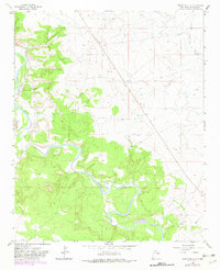
Puerto de Luna serves as the focal point for this mid-century topographic study, positioned where the valley floor meets the intricate meanders of the Pecos River. The settlement is defined by its deep historical ties to the landscape, evidenced by the Nuestra Señora de Refugio Cem and a complex irrigation system including the East Puerto de Luna Ditch and West Puerto de Luna Ditch. These ditches underscore the vital role of water management in sustaining agricultural life within the Guadalupe County basin.
Find a feature on this map
11 named features on this map. Tap any name to fly to it.
Don’t see what you’re looking for? This feature index may not catch every label — zoom into the map to look around manually.
Map Details
Editions of this 1963 Puerto De Luna Map
2 editions found
Other maps of this area

1954 · Fort Sumner
USGS Topo · 1:250,000

1958 · Fort Sumner
USGS Topo · 1:250,000

1963 · Santa Rosa
USGS Topo · 1:24,000

1963 · Puerto Creek
USGS Topo · 1:24,000

1963 · Sunshine Mesa
USGS Topo · 1:24,000

1964 · Fallon Ranch
USGS Topo · 1:24,000
1964 · Harben Lake
USGS Topo · 1:24,000

1966 · Gibbons Ranch
USGS Topo · 1:24,000

1966 · Ojo Negro Creek
USGS Topo · 1:24,000

1966 · Borica
USGS Topo · 1:24,000