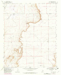
1968 Map of Candy Mesa
USGS Topo · Published 1982About this map
Gerhardt Valley and the surrounding high plains of eastern New Mexico are defined by a dramatic escarpment that separates the lower valley floor from the elevated tablelands of Taiban Mesa and Candy Mesa. This 1968 field-checked survey reveals a sparsely populated ranching landscape where development is limited to isolated operations like Knighten Ranch and the M and M Ranch at the base of the mesa.
Find a feature on this map
11 named features on this map. Tap any name to fly to it.
Don’t see what you’re looking for? This feature index may not catch every label — zoom into the map to look around manually.
Map Details
Editions of this 1968 Candy Mesa Map
2 editions found
Other maps of this area

1954 · Fort Sumner
USGS Topo · 1:250,000

1954 · Clovis
USGS Topo · 1:250,000

1958 · Fort Sumner
USGS Topo · 1:250,000

1958 · Clovis
USGS Topo · 1:250,000

1968 · Hassell
USGS Topo · 1:24,000

1968 · Twin Mesa NW
USGS Topo · 1:24,000

1968 · Fort Sumner East
USGS Topo · 1:24,000

1968 · Candy Mesa
USGS Topo · 1:24,000

1968 · Taiban
USGS Topo · 1:24,000

1968 · Twin Mesa
USGS Topo · 1:24,000