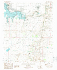
1989 Map of Logan South
USGS Topo · Published 1989About this map
Logan sits at the northern edge of this high plains landscape, overlooking the expansive waters of Ute Reservoir. The area is defined by the intersection of water management and local agriculture, where the Canadian River and its meandering tributary Revuelto Creek carve through the terrain south of the town. This 1980s-era documentation highlights the development of Ute Lake State Park, showing established recreation infrastructure like a Boat Ramp, Picnic Area, and Trailer Park that cater to visitors of the reservoir.
Find a feature on this map
26 named features on this map. Tap any name to fly to it.
Don’t see what you’re looking for? This feature index may not catch every label — zoom into the map to look around manually.
Map Details
Editions of this 1989 Logan South Map
This is the sole edition of this map. No revisions or reprints were ever made.
Other maps of this area

1930 · Tucumcari
USGS Topo · 1:125,000

1954 · Tucumcari
USGS Topo · 1:250,000

1958 · Tucumcari
USGS Topo · 1:250,000

1962 · Logan
USGS Topo · 1:62,500

1968 · Porter
USGS Topo · 1:24,000

1968 · Hudson
USGS Topo · 1:24,000

1968 · San Jon NW
USGS Topo · 1:24,000

1968 · Lesbia
USGS Topo · 1:24,000

1968 · Montesito Creek
USGS Topo · 1:24,000
1989 · Tuscocoillo Canyon
USGS Topo · 1:24,000